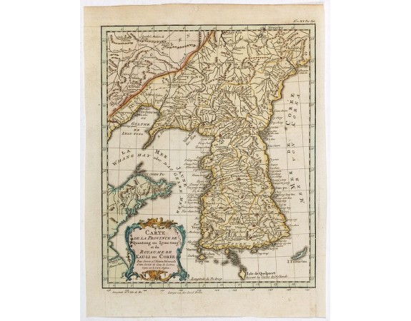
BELLIN, J.N. - Carte de la province de Quan-tong, ou Lyau-tong et du Royaume de Kau-li. . .

BELLIN, J.N. - Carte de la province de Quan-tong, ou Lyau-tong et du Royaume de Kau-li. . .
Published: Paris, 1757
Size: 262 x 214mm.
Color: Coloured
Condition: Good condition.
Description
Map of Korea. The map is of interest for the use of "East Sea", the sea between Korea and Japan, here called "Mer de Corée.
Decorative title cartouche in lower left corner.
The language on the map is in French. The notation at the bottom of the title cartouche notes that the map was copied after a English map. A note at "Isle de Quelpaert" indicates that the island was drawn after Dutch maps.
Decorative title cartouche in lower left corner.
The language on the map is in French. The notation at the bottom of the title cartouche notes that the map was copied after a English map. A note at "Isle de Quelpaert" indicates that the island was drawn after Dutch maps.
500€
- Reference N°: 42138
2914 views
 Click on image to zoom
