Near & Middle East general
The Silk Road extended approximately 6,437 kilometers (4,000 miles) across some of the world’s most formidable landscapes, including the Gobi Desert, the Pamir Mountains and traversed several of Uzbekistan’s major cities, including Samarkand, Bukhara and Khiva. The roads were typically in poor condition. Robbers were common. To protect themselves, traders joined together in caravans with camels or other pack animals. Over time, large inns called caravanserais cropped up to house travelling merchants.
One of the most famous travelers of the Silk Road was Marco Polo (1254 C.E. –1324 C.E.). Born into a family of wealthy merchants in Venice, Italy, Marco traveled with his father to China (then Cathay) when he was just 17 years of age.
It is hard to overstate the importance of the Silk Road on history. Religion and ideas spread along the Silk Road just as fluidly as goods. Towns along the route grew into multicultural cities.
The exchange of information gave rise to new technologies and innovations that would change the world.
The below antique maps are available for immediate sale, they are sold with a certificate of authenticity and published at the date indicated in the catalog description.
One of the most famous travelers of the Silk Road was Marco Polo (1254 C.E. –1324 C.E.). Born into a family of wealthy merchants in Venice, Italy, Marco traveled with his father to China (then Cathay) when he was just 17 years of age.
It is hard to overstate the importance of the Silk Road on history. Religion and ideas spread along the Silk Road just as fluidly as goods. Towns along the route grew into multicultural cities.
The exchange of information gave rise to new technologies and innovations that would change the world.
Antique maps including the Silk Route region
The below antique maps are available for immediate sale, they are sold with a certificate of authenticity and published at the date indicated in the catalog description.
Location: 1513
Published: Strasbourg, J. Schott, 1513
Size: 365 x 535mm.
Color: In attactive original colours.
Condition: Carte gravée sur bois. Magnifique exemplaire en coloris d'époque. - Repair of a small tear in upper tight hand margin, for the rest in mint condition.
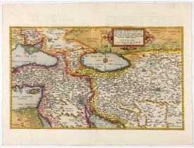
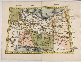
Fine old color example of Martin Waldseemuller's important early map of Persia, Armenia and the region between the Caspian Se..
4,500€
Location: 1513
Published: Strasbourg, J. Schott,1513
Size: 365 x 535mm.
Color: In attactive original colors
Condition: Carte gravée sur bois. Magnifique exemplaire en coloris d'époque. - Mint condition.
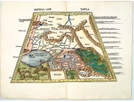
Trapezoidal woodcut map showing the area east of the Caspian Sea with the Aral Sea from Martin Waldseemüller's most important..
7,000€
Location: 1541
Published: Vienna, 1525 -1541
Size: 310 x 435mm.
Color: In attractive strong period correct colours.
Condition: Paper very little age-toned as usual. Good margins. With letter press and decorated initials on verso. Size of paper 41x55cm.
Wood block printed map and one of earliest printed representation of Near East prepared Martin Waldseemüller.Based on the sli..
750€
Location: 1578
Published: Antwerp, 1578
Size: 301 x 509mm.
Color: Colored
Condition: In very good condition.
The Very Rare First State. Turkey/ Holy Land/ Iran/ Iraq/ Arabia/ Afghanistan. A superb example of the rare 1578 edition of t..
4,500€
Location: 1650
Published: Paris, ca 1650
Size: 145 x 165mm.
Color: In original o/l colours.
Condition: Very good condition.
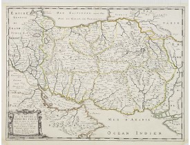
Map of the empire of Persia is shown to extent from Baghdad, almost to the present-day borders of India. Including part of Sa..
300€
Location: 1686
Published: Paris, 1686
Size: 100 x 123mm.
Color: Uncoloured.
Condition: Map cut on neat line and contemporarily pasted on a larger sheet of paper. Slight marginal browning. Very good and dark impression.
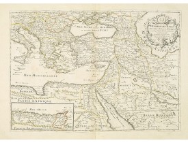
A nice map showing the Turkish Empire, including an inset map of kingdom of Alger. Extending from Italy and the Eastern Medit..
500€
Location: 1783
Published: Paris, 1783
Size: 187 x 450mm.
Color: In original colours.
Condition: In good condition. Paper very slightly age-toned.
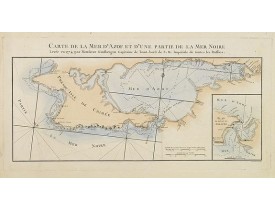
Engraved map of the Crimean Peninsula with the Black Sea and the Sea of Azov in Russia. From the Atlas Volume of "Histoire ph..
300€
Location: 1785
Published: Paris, ca. 1785
Size: 260 x 152mm.
Color: Uncoloured.
Condition: In very good condition.
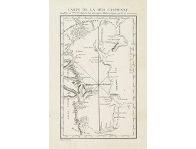
Detailed of the Caspian Sea, prepared by Jean Antoine Guldenstaedt (1745-1781), who was a Russian naturalist and physician, b..
180€
Showing 1 to 8 of 8 (1 Pages)

![PTOLEMY,C ./ TRECHSEL, G. - [Near East] PTOLEMY,C ./ TRECHSEL, G. - [Near East]](https://www.loeb-larocque.com/eshop/image/cache/catalog/image/new_upload/33849-275x210w.jpg)
