Central Asia
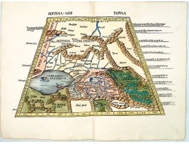
Location: 1513
Published: Strasbourg, J. Schott,1513
Size: 365 x 535mm.
Color: In attactive original colors
Condition: Carte gravée sur bois. Magnifique exemplaire en coloris d'époque. - Mint condition.
Trapezoidal woodcut map showing the area east of the Caspian Sea with the Aral Sea from Martin Waldseemüller's most important..
7,000€
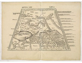
Location: 1513
Published: Strasburg, 1513
Size: 340 x 545mm.
Color: Uncoloured.
Condition: Good impression. Some minor discolouration and water staining in outer margin. Paper slightly age toned. Some old backing along center fold due to some small splits. Printed on heavy paper.
A woodblock-printed large-format Ptolemaic map showing the region east of the Caspian Sea is labeled SOGDIANA. Sogdia or Sogd..
7,000€
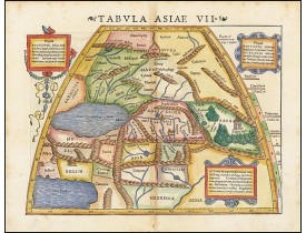
Location: 1542
Published: Basle, 1542
Size: 270 x 345mm.
Color: Colored
Condition: Wood block print with letter press. Good impression.
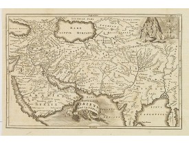
Attractive woodblock map, depicting the Caspian Sea, Black Sea and the Persian Gulf, extending to the Imaus Mountains, accor..
600€
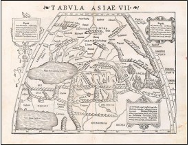
Location: 1542
Published: Basle, 1542
Size: 270 x 345mm.
Color: Uncolored
Condition: Wood block print with letter press. Good impression.
Attractive woodblock map, depicting the Caspian Sea, Black Sea and the Persian Gulf, extending to the Imaus Mountains, accor..
500€
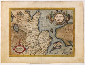
Location: 1590
Published: Antwerp, c. 1590
Size: 382 x 500mm.
Color: In attractive strong original colours.
Condition: Paper very slightly age-toned. Dark impression, printed on heavy paper. Some light offsetting due to oxidation of ink and colours. With French text on verso.
This is a very early depiction of the northern Pacific, with the first mapping of the Northwest Coast of America and probably..
1,500€
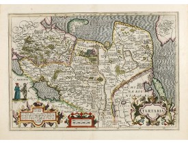
Location: 1633
Published: Amsterdam, 1633
Size: 342 x 495mm.
Color: In attractive strong original colours.
Condition: Some outer marginal discoloration. Paper very slightly age-toned, very good condition. French text on verso.
Published in Hondius' editions of the Mercator Atlas from 1606 onwards, showing China, Korea and the northern Pacific coast o..
1,000€
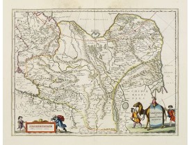
Location: 1658
Published: Amsterdam, 1658
Size: 382 x 502mm.
Color: Original colours.
Condition: Printed on heavy paper. Some light water staining in upper margin, hardly affecting the engraved area. Dutch text on verso. Wide margins, very good impression, near to mint condition. Dutch text on verso.
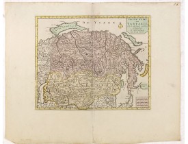
This is a detailed and decorative map of the Tartary and northern part of China, including the Chinese Great Wall, the Caspia..
600€
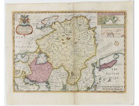
Location: 1700
Published: Oxford, 1700
Size: 360 x 500mm.
Color: Uncoloured.
Condition: Repair to centrefold, three brown ink marks to top margin. Map has been cleaned. Slight plate wear. Some paper thinning. Good overall condition.
Two insets show the land to the northeast of China, according to Jesuit information. The map stretches from northern Russia a..
800€
Location: 1719
Published: Leiden, 1719
Size: 270 x 352mm.
Color: Uncoloured.
Condition: Generally in fine condition. Dark impression.
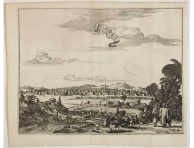
Decorative view of Kashan in Iran. A branch of the Silk Road skirts the western and southern edges of Iran's central desert, ..
300€
Location: 1719
Published: Leiden, 1719
Size: 295 x 350mm.
Color: Uncoloured.
Condition: Paper very slightly age toned but generally in fine condition. Dark impression.
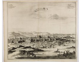
Decorative view of Astrakhan. Astrakhan is where Europe ends and Central Asia begins. Its position on the Caspian Sea has ens..
300€
Location: 1719
Published: Leiden, 1719
Size: 285 x 335mm.
Color: Uncoloured.
Condition: Paper very slightly age toned but generally in fine condition. Dark impression.
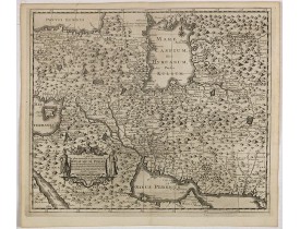
This is a decorative map of Persia and Central Asia. It has very good details of the region east of the Caspian Sea, showing ..
400€
Location: 1723
Published: Paris, 1723
Size: 620 x 419mm.
Color: Original o/l colour.
Condition: Printed on heavy paper, slightly age-toned as usual. Good impression. Excellent condition.
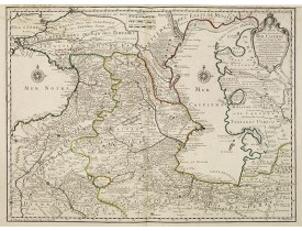
The map shows the area east of the Caspian Sea, including parts of Kazakhstan, Turkmenistan, Uzbekistan, and northern Iran. T..
600€
Location: 1732
Published: Leipzig, Gledisch, 1732
Size: 200 x 300mm.
Color: Uncoloured.
Condition: Paper slightly age-toned. Dark impression.
Uncommon map of Persia, Armenia, Arabian Peninsular and part of India. Prepared by Christoph Cellarius (1638-1707). From Geo..
80€
Location: 1735
Published: Nuremberg, 1735
Size: 489 x 586mm.
Color: Original colors
Condition: Paper slightly age-toned.
This is the first printed map specifically of the Uzbek region. The map shows the area around the Caspian Sea and northern Ir..
800€
Location: 1737
Published: The Hague, 1737
Size: 470 x 685mm.
Color: In original colours.
Condition: Paper broken on centerfold and other places due to oxidation of green ink. Good and dark impression.
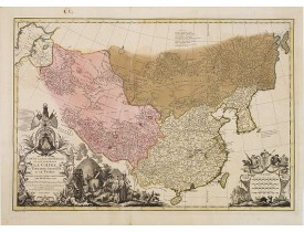
It has a quite elaborate pictorial cartouche engraved by G. Kondet. It is a very detailed map of China, Tibet, and Korea.In t..
2,500€
Location: 1750
Published: Amsterdam, 1750
Size: 280 x 343mm.
Color: Original colours.
Condition: In very attractive original colours. Wide margins.
A map of Tartary, Korea and part of Japan. The map is most notable for the confusion between Kamchatka and Iesso.There are ve..
300€
Location: 1784
Published: Venice, 1776 - 1784
Size: 476 x 606mm.
Color: In original o/l colours.
Condition: Slight marginal spotting. Lower margin short, as issued. Else very good condition.
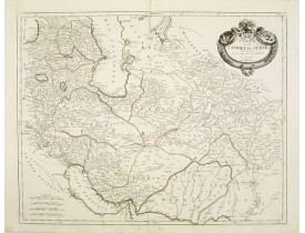
Finely and crisply engraved map of the Persian Empire during the 18th century. It shows the Caspian Sea in the north to the P..
350€
Location: 1785
Published: Paris, Ph.-D. Pierres, Clousier [- Moutard], 1785
Size: 515 x 805mm.
Color: Uncoloured.
Condition: A very good and dark impression. Folded as issued. Printed on thick paper.
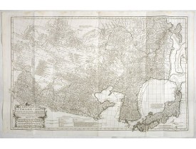
This is a very detailed map of the region from Japan to the Gobi Desert, centered on Mongolia and Korea, from D'Anville's Atl..
1,500€
Location: 1787
Published: Paris, Mondhare, 1787
Size: 960 x 1221mm.
Color: Original outline colors.
Condition: Printed on four sheets. Joined and mounted on canvas. The paper is slightly browned. Some minor localized staining and foxing. Some minor folds and minor wrinkles. Two small losses of paper at the lower right and left part. Good impression. Some pinholes due to ancient display.
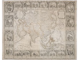
Spectaculaire carte murale entourée d'une superbe bordure dans le style Rococo, constituée de 20 scènes à sujets historiques ..
6,000€
Location: 1788
Published: Rome, 1788
Size: 330 x 465mm.
Color: In original o/l colours.
Condition: Good and dark impression, some light marginal foxing, generally in good condition.
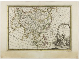
First edition on laid paper. Cassini’s splendid map depicts Asia at the end of the eighteenth century. Good details are provi..
750€
Location: 1792
Published: Amsterdam, 1792
Size: 177 x 213mm.
Color: Original colours.
Condition: In good condition.
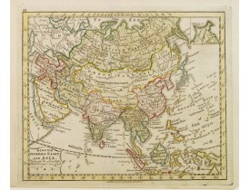
Uncommon map of Asia, with Dutch text. Engraved by A.Krevelt. In the upper right-hand corner, inset the map of Siberia. The r..
100€
Location: 1806
Published: Paris,1801-1806
Size: 175 x 110mm.
Color: In attractive original colours.
Condition: In very good condition.
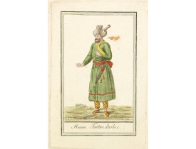
Originally hand-colored costume mezzotint of a man from Uzbekistan engraved by Félix Mixelle and Lachaussée Jeune after Jacqu..
25€
Location: 1806
Published: Paris,1801-1806
Size: 170 x 110mm.
Color: In attractive original colours.
Condition: In very good condition.
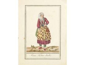
Originally hand-colored costume mezzotint of a woman from Uzbekistan engraved by Félix Mixelle and Lachaussée Jeune after Jac..
25€
Location: 1810
Published: Paris, c. 1810
Size: 185 x 230mm.
Color: In original o/l colours.
Condition: In very good condition.
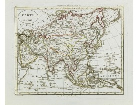
Fine map of Asia, with an interesting representations of Japan, Hokkaido, Sakhalin Island, Kamchatka and Korea. Engraved by A..
150€


