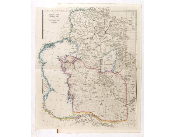
ARROWSMITH, J. - The Caspian sea Khivah and the surrounding country

Description
The map is filled with place names, roads, and various notes on the region. The Aral Sea is prominent, with a large island in the center and notes such as, "According to the level ascertained barometrically in 1826, Lake Aral has 13 Toises 3/10 higher than that of the Caspian Sea."
Published by John Arrowsmith (1790-1873) in his "The London Atlas of Universal Geography, Exhibiting the Physical & Political Divisions of the Various Countries of the World. . .".
This Atlas was published in several editions from 1832-1846, and volumes were made up individually for purchasers.
The Arrowsmiths were a cartographic dynasty that operated from the late eighteenth to the mid-nineteenth century. The family business was founded by Aaron Arrowsmith (1750-1823), who was renowned for carefully prepared and meticulously updated maps, globes, and charts.
Aaron Arrowsmith was born in County Durham in 1750. He came to London for work around 1770, where he found employment as a surveyor for the city’s mapmakers.
Aaron Arrowsmith died in 1823, and the business and title of Hydrographer to the King passed to his sons, Aaron and Samuel, and, later, his nephew, John. Aaron Jr. (1802-1854)
John (1790-1873) operated his own independent business after his uncle, Aaron Arrowsmith Sr., died. After 1839, John moved into the Soho premises of his uncle and cousins. John enjoyed considerable recognition in the geography and exploration community. Like Aaron Jr., John was a founding member of the RGS and would serve as its unofficial cartographer for 43 years.
- See other items by this publisher: WYLD, J.
- Reference N°: 34581
 Click on image to zoom
